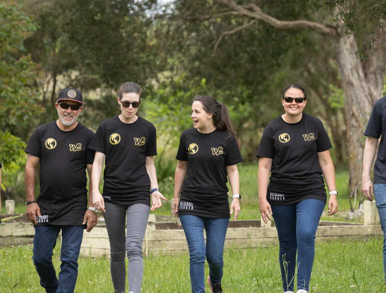
Li B; Chen Z; Lim S, 2021, 'Geolocation Inference Using Twitter Data: A Case Study of COVID-19 in the Contiguous United States', in Geographical Information Systems Theory, Applications and Management, Springer International Publishing, pp. 119 - 139, http://dx.doi.org/10.1007/978-3-030-76374-9_8
Chen Z; Pokharel B; Li B; Lim S, 2021, 'Location Extraction from Twitter Messages Using a Bidirectional Long Short-Term Memory Neural Network with Conditional Random Field Model', in Geographical Information Systems Theory, Applications and Management, Springer International Publishing, pp. 18 - 30, http://dx.doi.org/10.1007/978-3-030-76374-9_2
Iqbal U; Lim S, 2008, 'Location Privacy in Automotive Telematics', in Karimi HA (ed.), Handbook of Research on Geoinformatics, Information Science Reference, United States of America, pp. 293 - 301, http://dx.doi.org/10.4018/978-1-59140-995-3.ch037
Fowler D; Middleton P; Lim S, 2022, 'Extending floating catchment area methods to estimate future hospital bed capacity requirements', Spatial and Spatio-temporal Epidemiology, vol. 43, pp. 100544 - 100544, http://dx.doi.org/10.1016/j.sste.2022.100544
Hosseini M; Lim S, 2022, 'Gene expression programming and data mining methods for bushfire susceptibility mapping in New South Wales, Australia', Natural Hazards, vol. 113, pp. 1349 - 1365, http://dx.doi.org/10.1007/s11069-022-05350-7
Qi J; Ding L; Lim S, 2022, 'A Decision-Making Framework to Support Urban Heat Mitigation by Local Governments', Resources, Conservation and Recycling, vol. 184, http://dx.doi.org/10.1016/j.resconrec.2022.106420
Akbarian S; Xu C; Wang W; Ginns S; Lim S, 2022, 'Sugarcane yields prediction at the row level using a novel cross-validation approach to multi-year multispectral images', Computers and Electronics in Agriculture, vol. 198, pp. 107024 - 107024, http://dx.doi.org/10.1016/j.compag.2022.107024
Akbarian S; Xu C; Wang W; Ginns S; Lim S, 2022, 'An investigation on the best-fit models for sugarcane biomass estimation by linear mixed-effect modelling on unmanned aerial vehicle-based multispectral images: A case study of Australia', Information Processing in Agriculture, http://dx.doi.org/10.1016/j.inpa.2022.03.005
Alvioli M; Marchesini I; Pokharel B; Gnyawali K; Lim S, 2022, 'Geomorphological slope units of the Himalayas', Journal of Maps, http://dx.doi.org/10.1080/17445647.2022.2052768
Li B; Gao J; Chen S; Lim S; Jiang H, 2022, 'POI Detection of High-Rise Buildings Using Remote Sensing Images: A Semantic Segmentation Method Based on Multitask Attention Res-U-Net', IEEE Transactions on Geoscience and Remote Sensing, vol. 60, pp. 1 - 1, http://dx.doi.org/10.1109/TGRS.2022.3174399
Liu J; Freudenberger D; Lim S, 2022, 'Mapping burned areas and land-uses in Kangaroo Island using an object-based image classification framework and Landsat 8 Imagery from Google Earth Engine', Geomatics, Natural Hazards and Risk, vol. 13, pp. 1867 - 1897, http://dx.doi.org/10.1080/19475705.2022.2098066
Qi J; Ding L; Lim S, 2021, 'Toward cool cities and communities: A sensitivity analysis method to identify the key planning and design variables for urban heat mitigation techniques', Sustainable Cities and Society, vol. 75, http://dx.doi.org/10.1016/j.scs.2021.103377
Pokharel B; Alvioli M; Lim S, 2021, 'Assessment of earthquake-induced landslide inventories and susceptibility maps using slope unit-based logistic regression and geospatial statistics', Scientific Reports, vol. 11, http://dx.doi.org/10.1038/s41598-021-00780-y
Shahabi H; Rahimzad M; Piralilou ST; Ghorbanzadeh O; Homayouni S; Blaschke T; Lim S; Ghamisi P, 2021, 'Unsupervised deep learning for landslide detection from multispectral sentinel-2 imagery', Remote Sensing, vol. 13, pp. 4698 - 4698, http://dx.doi.org/10.3390/rs13224698
Chen Z; Lim S, 2021, 'Social media data-based typhoon disaster assessment', International Journal of Disaster Risk Reduction, vol. 64, pp. 102482 - 102482, http://dx.doi.org/10.1016/j.ijdrr.2021.102482
Xu Y; Shen X; Lim S; Li X, 2021, 'Three-Dimensional Object Detection with Deep Neural Networks for Automatic As-Built Reconstruction', Journal of Construction Engineering and Management, vol. 147, pp. 04021098 - 04021098, http://dx.doi.org/10.1061/(ASCE)CO.1943-7862.0002003
Stone H; Lim S; Kunasekaran M, 2021, 'Greater Sydney SARS-CoV-2 Observations from the 16th of June to the 13th of July', Global Biosecurity, http://dx.doi.org/10.31646/gbio.125/
Stone H; Lim S; Kunasekaran M; Nunes-Vaz R, 2021, 'Greater Sydney SARS-CoV-2 Observations from the 16th of June to the 13th of July', Global Biosecurity, vol. 3, http://dx.doi.org/10.31646/gbio.125
Xu Y; Shen X; Lim S, 2021, 'CorDet: Corner-Aware 3D Object Detection Networks for Automated Scan-to-BIM', Journal of Computing in Civil Engineering, vol. 35, pp. 04021002 - 04021002, http://dx.doi.org/10.1061/(ASCE)CP.1943-5487.0000962
Pokharel B; Althuwaynee OF; Aydda A; Kim SW; Lim S; Park HJ, 2021, 'Spatial clustering and modelling for landslide susceptibility mapping in the north of the Kathmandu Valley, Nepal', Landslides, vol. 18, pp. 1403 - 1419, http://dx.doi.org/10.1007/s10346-020-01558-5
Hosseini M; Lim S, 2021, 'Gene expression programming and ensemble methods for bushfire susceptibility mapping: a case study of Victoria, Australia', Geomatics, Natural Hazards and Risk, vol. 12, pp. 2367 - 2386, http://dx.doi.org/10.1080/19475705.2021.1964618
Lim S, 2021, 'Cruise Ship Travel and the Spread of COVID-19 – Australia as a Case Study', International Journal of Travel Medicine and Global Health, http://dx.doi.org/10.34172/ijtmgh.2021.03
Qi J; Ding L; Lim S, 2020, 'Planning for cooler cities: A framework to support the selection of urban heat mitigation techniques', Journal of Cleaner Production, vol. 275, http://dx.doi.org/10.1016/j.jclepro.2020.122903
Quigley AL; Nguyen PY; Stone H; Lim S; MacIntyre CR, 2020, 'Cruise Ship Travel and the Spread of COVID-19 – Australia as a Case Study', International Journal of Travel Medicine and Global Health, vol. 9, pp. 10 - 18, http://dx.doi.org/10.34172/ijtmgh.2021.03
Asefi H; Zhang Y; Lim S; Maghrebi M; Shahparvari S, 2020, 'A multi-criteria decision support framework for municipal solid waste landfill siting: a case study of New South Wales (Australia)', Environmental Monitoring and Assessment, vol. 192, pp. 682, http://dx.doi.org/10.1007/s10661-020-08565-y
Chen X; Bahl P; De Silva C; Heslop D; Doolan C; Lim S; MacIntyre CR, 2020, 'Systematic Review and Evaluation of Mathematical Attack Models of Human Inhalational Anthrax for Supporting Public Health Decision Making and Response', Prehospital and Disaster Medicine, vol. 35, pp. 412 - 419, http://dx.doi.org/10.1017/S1049023X20000734
Liu L; Lim S; Shen X; Yebra M, 2020, 'Assessment of generalized allometric models for aboveground biomass estimation: A case study in Australia', Computers and Electronics in Agriculture, vol. 175, http://dx.doi.org/10.1016/j.compag.2020.105610
Qi Z; Lim S; Hossein Rashidi T, 2020, 'Assessment of transport equity to Central Business District (CBD) in Sydney, Australia', Transportation Letters, vol. 12, pp. 246 - 256, http://dx.doi.org/10.1080/19427867.2019.1584694
Asefi H; Zhang Y; Lim S; Maghrebi M, 2020, 'An integrated approach to suitability assessment of municipal solid waste landfills in New South Wales, Australia', Australasian Journal of Environmental Management, vol. 27, pp. 63 - 83, http://dx.doi.org/10.1080/14486563.2020.1719438
Qi J; Ding L; Lim S, 2020, 'Ontology-based knowledge representation of urban heat island mitigation strategies', Sustainable Cities and Society, vol. 52, http://dx.doi.org/10.1016/j.scs.2019.101875
Shirowzhan S; Lim S; Trinder J; Li H; Sepasgozar SME, 2020, 'Data mining for recognition of spatial distribution patterns of building heights using airborne lidar data', Advanced Engineering Informatics, vol. 43, pp. 101033 - 101033, http://dx.doi.org/10.1016/j.aei.2020.101033
Ghorbanzadeh O; Shahabi H; Mirchooli F; Valizadeh Kamran K; Lim S; Aryal J; Jarihani B; Blaschke T, 2020, 'Gully erosion susceptibility mapping (GESM) using machine learning methods optimized by the multi‑collinearity analysis and K-fold cross-validation', Geomatics, Natural Hazards and Risk, vol. 11, pp. 1653 - 1678, http://dx.doi.org/10.1080/19475705.2020.1810138
Gao Q; Lim S, 2019, 'A probabilistic fusion of a support vector machine and a joint sparsity model for hyperspectral imagery classification', GIScience and Remote Sensing, vol. 56, pp. 1129 - 1147, http://dx.doi.org/10.1080/15481603.2019.1623003
Gao Q; Lim S, 2019, 'Classification of hyperspectral images with convolutional neural networks and probabilistic relaxation', Computer Vision and Image Understanding, vol. 188, http://dx.doi.org/10.1016/j.cviu.2019.102801
Gao Q; Lim S; Jia X, 2019, 'Spectral-spatial hyperspectral image classification using a multiscale conservative smoothing scheme and adaptive sparse representation', IEEE Transactions on Geoscience and Remote Sensing, vol. 57, pp. 7718 - 7730, http://dx.doi.org/10.1109/TGRS.2019.2915809
Asefi H; Shahparvari S; Chettri P; Lim S, 2019, 'Variable fleet size and mix VRP with fleet heterogeneity in Integrated Solid Waste Management', Journal of Cleaner Production, vol. 230, pp. 1376 - 1395, http://dx.doi.org/10.1016/j.jclepro.2019.04.250
Liu L; Lim S; Shen X; Yebra M, 2019, 'A multiscale morphological algorithm for improvements to canopy height models', Computers and Geosciences, vol. 130, pp. 20 - 31, http://dx.doi.org/10.1016/j.cageo.2019.05.012
Liu L; Lim S; Shen X; Yebra M, 2019, 'A hybrid method for segmenting individual trees from airborne lidar data', Computers and Electronics in Agriculture, vol. 163, http://dx.doi.org/10.1016/j.compag.2019.104871
Zhang Y; Lim S, 2019, 'Drivers of Wildfire occurrence patterns in the inland riverine environment of New South Wales, Australia', Forests, vol. 10, http://dx.doi.org/10.3390/f10060524
Asefi H; Lim S; Maghrebi M; Shahparvari S, 2019, 'Mathematical modelling and heuristic approaches to the location-routing problem of a cost-effective integrated solid waste management', Annals of Operations Research, vol. 273, pp. 75 - 110, http://dx.doi.org/10.1007/s10479-018-2912-1
Liu X; Lim S, 2018, 'An agent-based evacuation model for the 2011 Brisbane City-scale riverine flood', Natural Hazards, vol. 94, pp. 53 - 70, http://dx.doi.org/10.1007/s11069-018-3373-1
Liu L; Lim S, 2018, 'A voxel-based multiscale morphological airborne lidar filtering algorithm for digital elevation models for forest regions', Measurement: Journal of the International Measurement Confederation, vol. 123, pp. 135 - 144, http://dx.doi.org/10.1016/j.measurement.2018.03.020
Raina MacIntyre C; Engells TE; Scotch M; Heslop DJ; Gumel AB; Poste G; Chen X; Herche W; Steinhöfel K; Lim S; Broom A, 2018, 'Converging and emerging threats to health security', Environment Systems and Decisions, vol. 38, pp. 198 - 207, http://dx.doi.org/10.1007/s10669-017-9667-0
Gao Q; Lim S; Jia X, 2018, 'Improved joint sparse models for hyperspectral image classification based on a novel neighbour selection strategy', Remote Sensing, vol. 10, http://dx.doi.org/10.3390/rs10060905
Chen Z; Lim S, 2018, 'Collecting typhoon disaster information from twitter based on query expansion', ISPRS International Journal of Geo-Information, vol. 7, http://dx.doi.org/10.3390/ijgi7040139
Figueroa LLL; Lim S; Lee J, 2018, 'Modelling the effect of deprived physical urban environments on academic performance in the Philippines', GeoJournal, vol. 83, pp. 13 - 30, http://dx.doi.org/10.1007/s10708-016-9751-x
Gao Q; Lim S; Jia X, 2018, 'Hyperspectral image classification using convolutional neural networks and multiple feature learning', Remote Sensing, vol. 10, http://dx.doi.org/10.3390/rs10020299
Gao Q; Lim S; Jia X, 2018, 'Hyperspectral image classification using joint sparse model and discontinuity preserving relaxation', IEEE Geoscience and Remote Sensing Letters, vol. 15, pp. 78 - 82, http://dx.doi.org/10.1109/LGRS.2017.2774253
Asefi H; Lim S, 2017, 'A novel multi-dimensional modeling approach to integrated municipal solid waste management', Journal of Cleaner Production, vol. 166, pp. 1131 - 1143, http://dx.doi.org/10.1016/j.jclepro.2017.08.061
Zhang Y; Lim S; Sharples JJ, 2017, 'Effects of climate on the size of wildfires in the Eucalyptus camaldulensis forests and the dry lands of the Riverina Bioregion, Australia', Forest Ecology and Management, vol. 401, pp. 330 - 340, http://dx.doi.org/10.1016/j.foreco.2017.07.009
Maghrebi M; Lim S; Asefi H, 2017, 'Adaptation of simulated annealing to an integrated municipal solid waste location-routing problem', International Journal of Logistics Systems and Management, vol. 28, pp. 127 - 143, http://dx.doi.org/10.1504/IJLSM.2017.086348
Zhang Y; Lim S; Sharples JJ, 2017, 'Wildfire occurrence patterns in ecoregions of New South Wales and Australian Capital Territory, Australia', Natural Hazards, vol. 87, pp. 415 - 435, http://dx.doi.org/10.1007/s11069-017-2770-1
Liu X; Lim S, 2017, 'Flood Inundation Modelling for Mid-Lower Brisbane Estuary', River Research and Applications, vol. 33, pp. 415 - 426, http://dx.doi.org/10.1002/rra.3078
Liu L; Lim S, 2017, 'Color component-based road feature extraction from airborne lidar and imaging data sets', Journal of Surveying Engineering, vol. 143, http://dx.doi.org/10.1061/(ASCE)SU.1943-5428.0000198
Maghrebi M; Lim S; Asefi H, 2017, 'Adaptation of simulated annealing to an integrated municipal solid waste location-routing problem', International Journal of Logistics Systems and Management, vol. 28, pp. 127 - 127, http://dx.doi.org/10.1504/ijlsm.2017.10007117
Thatcher C; Lim S; Palaseanu-Lovejoy M; Danielson J; Kimbrow D, 2016, 'Lidar-based mapping of flood control levees in South Louisiana', International Journal of Remote Sensing, vol. 37, pp. 5708 - 5725, http://dx.doi.org/10.1080/01431161.2016.1249304
Zhang Y; Lim S; Sharples JJ, 2016, 'Modelling spatial patterns of wildfire occurrence in South-Eastern Australia', Geomatics, Natural Hazards and Risk, vol. 7, pp. 1800 - 1815, http://dx.doi.org/10.1080/19475705.2016.1155501
Figueroa LL; Lim S; Lee J, 2016, 'Investigating the relationship between school facilities and academic achievements through geographically weighted regression', Annals of GIS, vol. 22, pp. 1 - 13, http://dx.doi.org/10.1080/19475683.2016.1231717
Rabiee M; Jolai F; Asefi H; Fattahi P; Lim S, 2016, 'A biogeography-based optimisation algorithm for a realistic no-wait hybrid flow shop with unrelated parallel machines to minimise mean tardiness', International Journal of Computer Integrated Manufacturing, vol. 29, pp. 1007 - 1024, http://dx.doi.org/10.1080/0951192X.2015.1130256
Liu X; Lim S, 2016, 'Integration of spatial analysis and an agent-based model into evacuation management for shelter assignment and routing', Journal of Spatial Science, vol. 61, pp. 283 - 298, http://dx.doi.org/10.1080/14498596.2016.1147393
Liu L; Lim S, 2016, 'A framework of road extraction from airborne lidar data and aerial imagery', Journal of Spatial Science, vol. 61, pp. 263 - 281, http://dx.doi.org/10.1080/14498596.2016.1147392
Shirowzhan S; Lim S; Trinder J, 2016, 'Enhanced autocorrelation-based algorithms for filtering airborne lidar data over urban areas', Journal of Surveying Engineering, vol. 142, http://dx.doi.org/10.1061/(ASCE)SU.1943-5428.0000149
Figueroa LL; Lim S; Lee J, 2016, 'Spatial analysis to identify disparities in Philippine public school facilities', Regional Studies, Regional Science, vol. 3, pp. 1 - 27, http://dx.doi.org/10.1080/21681376.2015.1099465
Hamid NZAA; Lim S; Jha S, 2016, 'An Improved Parcel-Based Approach to Bruneian Geocoded Address Database', INTERNATIONAL JOURNAL OF SPATIAL DATA INFRASTRUCTURES RESEARCH, vol. 11, pp. 73 - 97, http://dx.doi.org/10.2902/1725-0463.2016.11.art5
Aghighi H; Trinder J; Lim S; Tarabalka Y, 2015, 'Fully spatially adaptive smoothing parameter estimation for Markov random field super-resolution mapping of remotely sensed images', International Journal of Remote Sensing, vol. 36, pp. 2851 - 2879, http://dx.doi.org/10.1080/01431161.2015.1049381
Hamid NZA; Lim S; Jha SK, 2015, 'Quality control for the development of the bruneian geocoded address database', URISA Journal, vol. 27, pp. 47 - 56
Asefi H; Lim S; Maghrebi M, 2015, 'A mathematical model for the municipal solid waste location-routing problem with intermediate transfer stations', Australasian Journal of Information Systems, vol. 19, pp. S21 - S35, http://dx.doi.org/10.3127/ajis.v19i0.1151
Aghighi H; Trinder J; Tarabalka Y; Lim S, 2014, 'Dynamic Block-Based Parameter Estimation for MRF Classification of High-Resolution Images', IEEE Geoscience and Remote Sensing Letters, vol. 11, pp. 1687 - 1691, http://dx.doi.org/10.1109/LGRS.2014.2305913
Farhan AR; Lim S, 2014, 'Assessment of ocean and coastal policy effectiveness in Seribu Islands, Indonesia', International Journal of Geoinformatics, vol. 10, pp. 51 - 62
Farhan AR; Lim S, 2014, 'Integrated Vulnerability Assessment on Small Island Regions Towards Integrated Coastal Zone Management (ICZM): A Case Study of Thousand Islands, Indonesia', International Journal of Geoinformatics, vol. 10, pp. 1 - 16, http://journals.sfu.ca/ijg/index.php/journal/issue/view/121
Lim S; Thatcher CA; Brock JC; Kimbrow DR; Danielson JJ; Reynolds BJ, 2013, 'Accuracy assessment of a mobile terrestrial lidar survey at Padre Island National Seashore', International Journal of Remote Sensing, vol. 34, pp. 6355 - 6366, http://dx.doi.org/10.1080/01431161.2013.800658
Farhan AR; Lim S, 2013, 'Improving Vulnerability Assessment Towards Integrated Coastal Zone Management (ICZM): A Case Study of Small Islands in Indonesia', Journal of Coastal Conservation, vol. 17, pp. 351 - 367, http://dx.doi.org/10.1007/s11852-013-0269-9
Aghighi H; Trinder J, 2013, 'Smoothing parameter estimation framework for Markov random field by using contextual and spectral information', 34th Asian Conference on Remote Sensing 2013, ACRS 2013, vol. 8892, pp. 88920T-88920T-10 - 88920T-88920T-10, http://dx.doi.org/10.1117/12.2028701
Al-shaery A; Zhang S; Lim S; Rizos C, 2012, 'A comparative study of mathematical modelling for GPS/GLONASS real-time kinematic (RTK)', 25th International Technical Meeting of the Satellite Division of the Institute of Navigation 2012, ION GNSS 2012, vol. 3, pp. 2231 - 2238
Farhan A; Lim S, 2012, 'Vulnerability assessment of ecological conditions in Seribu Islands, Indonesia', Ocean and Coastal Management, vol. 65, pp. 1 - 14, http://dx.doi.org/10.1016/j.ocecoaman.2012.04.015
Park H; Trinder J; Turner R; Lim S, 2011, 'Analysis of ground target data on airborne lidar', 32nd Asian Conference on Remote Sensing 2011, ACRS 2011, vol. 1, pp. 443 - 448
Park HJ; Turner R; Lim S; Trinder J; Moore D, 2011, 'Analysis of pine tree height estimation using full waveform lidar', 34th International Symposium on Remote Sensing of Environment - The GEOSS Era: Towards Operational Environmental Monitoring
Al-shaery A; Lim S; Rizos C, 2011, 'Investigation of different interpolation models using in Network-RTK for the Virtual Reference Station technique', Journal of Global Positioning Systems, Electronic, vol. 10, pp. 136 - 148
Ratanavong ; Lim S; Lee HS, 2011, 'Spatio-temporal trends in temperature, acidification and dissolved oxygen in Lower Mekong Basin for 1985-2005', Journal of the Korean Society for Geo-Spatial Information Systems, vol. XIX, pp. 3 - 12
Lee H; Lim S; Park DW, 2011, 'Application of terrestrial laser scanner and raster operations to change detection of beach', Journal of Coastal Research, vol. 64, pp. 1692 - 1696
Musa T; Amir S; Othman R; Ses S; Kamaludin O; Abdullah K; Lim S; Rizos C, 2011, 'GPS meteorology in a low-latitude region: Remote sensing of atmospheric water vapor over the Malaysian Peninsula', Journal of Atmospheric and Solar - Terrestrial Physics, vol. 73, pp. 2410 - 2422, http://dx.doi.org/10.1016/j.jastp.2011.08.014
Farhan AR; Lim S, 2011, 'Resilience assessment on coastline changes and urban settlements: A case study in Seribu Islands, Indonesia', Ocean and Coastal Management, vol. 54, pp. 391 - 400, http://dx.doi.org/10.1016/j.ocecoaman.2010.12.003
Park HJ; Salah M; Lim S, 2011, 'Accuracy of 3D models derived from aerial laser scanning and aerial ortho-imagery', Survey Review, vol. 43, pp. 109 - 122, http://dx.doi.org/10.1179/003962611X12894696204786
Lim S; Helinski B; Lee H, 2010, 'Geocorrelation of contributing factors to asthma in New South Wales', International Journal of Geoinformatics, vol. 6, pp. 41 - 48
Lee H; Lim S; Paik H, 2010, 'An assessment of fire-damaged forest using spatial analysis techniques', Journal of Spatial Science, vol. 55, pp. 289 - 301, http://dx.doi.org/10.1080/14498596.2010.524144
Farhan ; Lim S, 2010, 'Integrated coastal zone management towards Indonesia Global Ocean Observing System (Ina-GOOS): Review and recommendation', Ocean and Coastal Management, vol. 53, pp. 421 - 427, http://dx.doi.org/10.1016/j.ocecoaman.2010.06.015
Lim S; Norzahari F; Lee H, 2010, 'A GIS-Based Analysis of Potential Sewer Choke in Western Sydney Region', KSCE Journal of Civil Engineering, vol. 14, pp. 601 - 612, http://dx.doi.org/10.1007/s12205-010-0601-y
Iqbal U; Lim S, 2010, 'Privacy implications of automated GPS tracking and profiling', IEEE Technology and Society Magazine, vol. 29, pp. 39 - 46, http://dx.doi.org/10.1109/MTS.2010.937031
Park H; Lim S; Trinder J; Turner R, 2009, '3D modelling of individual trees using full-waveform lidar', 30th Asian Conference on Remote Sensing 2009, ACRS 2009, vol. 1, pp. 190 - 195
Rizos C; Lim S; Musa TA; Ses S; Sharifuddin A; Zhang K, 2009, 'Atmospheric remote sensing using GNSS in the Australasian Region: From temperate climates to the tropics', International Geoscience and Remote Sensing Symposium (IGARSS), vol. 2, http://dx.doi.org/10.1109/IGARSS.2009.5418076
Feng Y; Rizos C; Higgins M; Lim S; Tang M, 2009, 'Developing regional precise positioning services using the legacy and future GNSS receivers', Journal of Global Positioning Systems, Electronic, vol. 8, pp. 17 - 25, http://www.gnss.com.au/JoGPS/v8n1/JoGPS_v8n1p17-25.pdf
MacGill IF; Jakrawatana N; Moore SJ; Lim S, 2009, 'Spatial-Temporal Enchancements of Material Flux Analysis Methods, with Application to Cadmium Management in an Agricultural Region in Australia', Clean Technologies and Environmental Policy, vol. 12, pp. 389 - 400, http://dx.doi.org/10.1007/s10098-009-0226-3
Kazemi S; Lim S; Rizos C, 2009, 'Interactive and automated segmentation and generalisation of raster data', International Journal of Geoinformatics, vol. 5, pp. 65 - 73, http://www.gmat.unsw.edu.au/snap/publications/kazemi_etal2009b.pdf
Iqbal U; Lim S, 2008, 'A survey on users willingness-to-pay for privacy in mobility pricing systems', International Journal of Liability & Scientific Enquiry, vol. 1, pp. 306 - 317, http://dx.doi.org/10.1504/IJLSE.2008.017700
Lim S; Rizos C, 2008, 'A conceptual framework for server-based GNSS operations', Positioning, vol. 7, pp. 35 - 42, http://www.gmat.unsw.edu.au/snap/publications/lim&rizos2008b.pdf
Lim S; Rizos C; Musa TA, 2008, 'Application of running average function to non-dispersive network-based Real-Time Kinematic positioning', Positioning, vol. 7, pp. 58 - 65, http://www.gmat.unsw.edu.au/snap/publications/lim_etal2008c.pdf
Iqbal U; Lim S, 2008, 'Legal and ethical implications of GPS vulnerabilities', Journal of International Commercial Law and Technology, vol. 3, pp. 178 - 187, http://www.gmat.unsw.edu.au/snap/publications/usman&lim2008d.pdf
Lim S; Rizos C, 2007, 'A new framework for server-based and thin-client GNSS operations for high accuracy applications in surveying and Navigation', 20th International Technical Meeting of the Satellite Division of The Institute of Navigation 2007 ION GNSS 2007, vol. 2, pp. 2169 - 2177
Kazemi S; Lim S, 2007, 'Deriving multi-scale GEODATA from TOPO-250K road network data', Journal of Spatial Science, vol. 52, pp. 171 - 182, http://dx.doi.org/10.1080/14498596.2007.9635111
Iqbal U; Lim S, 2007, 'Designing privacy-aware mobility pricing systems based on user perspective', Journal of Location Based Services, vol. 1, pp. 274 - 299, http://dx.doi.org/10.1080/17489720802183415
Wang Z; Rizos C; Lim S, 2006, 'Single epoch algorithm based on Tikhonov Regularization for deformation monitoring using single frequency GPS receivers', Survey Review, vol. 38, pp. 682 - 688, http://dx.doi.org/10.1179/sre.2006.38.302.682
Lee HS; Park JK; Lim SS, 2005, 'Error assessment of attitude determination using wireless internet-based DGPS', Journal of the Korean Society of Surveying, Geodesy, Photogrammetry and Cartography, vol. 23, pp. 101 - 108
Lim S; TRAM B, 2004, 'Convergence of Block Decorrelation Method for the Integer Ambiguity Fix', Positioning, vol. 3, pp. 290 - 295, http://www.gmat.unsw.edu.au/wang/jgps/v3n12/v3n12p36.pdf
Kygu CB; Lim S, 2004, 'Study on the Improvement of the Positioning Accuracy for Inverted RTK Using FARA', Journal of the Korean Society of Surveying, Photogrammetry, and Cartography, vol. 22, pp. 217 - 223, http://img.kisti.re.kr/originalView/originalView.jsp?url=/soc_img/society//ksgpc/GCRHBD/2004/v22n3/GCRHBD_2004_v22n3_217.pdf
Han JH; Lim S, 2004, 'The Ionospheric Correction for the Stand-alone GPS', Journal of Korea Navigation Institute, vol. 8
Lim S; Schutz BE, 1996, 'Repeat ground track analysis for the geoscience laser altimeter system', Advances in the Astronautical Sciences, vol. 93 PART 2, pp. 1615 - 1618
Hosseini M; Shad R; Lim S, 2021, 'Landslide Susceptibility Mapping using Genetic Expression Programming', in IOP Conference Series: Earth and Environmental Science, http://dx.doi.org/10.1088/1755-1315/767/1/012042
Akbarian S; Xu CY; Lim S, 2020, 'Analysis on the effect of spatial and spectral resolution of different remote sensing data in sugarcane crop yield study', in ISPRS Annals of the Photogrammetry, Remote Sensing and Spatial Information Sciences, pp. 655 - 661, http://dx.doi.org/10.5194/isprs-Annals-V-3-2020-655-2020
Pokharel B; Alvioli M; Lim S, 2020, 'Relevance of morphometric predictors and completeness of inventories in earthquake-induced landslide susceptibility', in Alvioli M; Marchesini I; Melelli L; Guth P (eds.), Proceedings of the GEOMORPHOMETRY 2020 Conference, Italy, pp. 182 - 185, presented at GEOMORPHOMETRY 2020, Italy, 22 June 2020 - 26 June 2020, http://dx.doi.org/10.30437/GEOMORPHOMETRY2020_49
Li B; Chen Z; Lim S, 2020, 'Geolocation prediction from tweets: A case study of influenza-like illness in Australia', in GISTAM 2020 - Proceedings of the 6th International Conference on Geographical Information Systems Theory, Applications and Management, pp. 160 - 167
Chen Z; Pokharel B; Li B; Lim S, 2020, 'Location extraction from twitter messages using bidirectional long short-term memory model', in GISTAM 2020 - Proceedings of the 6th International Conference on Geographical Information Systems Theory, Applications and Management, pp. 45 - 50
Gao Q; Lim S, 2018, 'Hyperspectral image classification based on a convolutional neural network and discontinuity preserving relaxation', in International Geoscience and Remote Sensing Symposium (IGARSS), pp. 3591 - 3594, http://dx.doi.org/10.1109/IGARSS.2018.8517463
Gao Q; Lim S; Jia X, 2017, 'Classification of hyperspectral imagery based on dictionary learning and extended multi-attribute profiles', in Lecture Notes in Computer Science (including subseries Lecture Notes in Artificial Intelligence and Lecture Notes in Bioinformatics), Shanghai, China, pp. 358 - 369, presented at 9th International Conference, ICIG 2017, Shanghai, China, 13 September 2017 - 15 September 2017, http://dx.doi.org/10.1007/978-3-319-71598-8_32
Tamjis MR; LIM , 2015, 'Automatic Visual Identification of Correct Matches in UAV Images for Visual-Based Attitude Estimation and Camera Self-Calibration', in Mouchaweh MS; Fleury A; Angelov P; Iglesias JA (eds.), Automatic Visual Identification of Correct Matches in UAV Images for Visual-Based Attitude Estimation and Camera Self-Calibration, Douai, France, presented at 2015 IEEE International Conference on Evolving and Adaptive Intelligent Systems (EAIS), Douai, France, 01 December 2015 - 03 December 2015, http://dx.doi.org/10.1109/EAIS.2015.7368788
Zhang Y; Lim S; Sharples JJ, 2015, 'Development of spatial models for bushfire occurrence in South-Eastern Australia', in Weber T; McPhee MJ; Anderssen RS (eds.), 21ST INTERNATIONAL CONGRESS ON MODELLING AND SIMULATION (MODSIM2015), MODELLING & SIMULATION SOC AUSTRALIA & NEW ZEALAND INC, Gold Coast, pp. 326 - 332, presented at 21st International Congress on Modelling and Simulation (MODSIM2015), Gold Coast, 29 November 2015 - 04 December 2015, http://gateway.webofknowledge.com/gateway/Gateway.cgi?GWVersion=2&SrcApp=PARTNER_APP&SrcAuth=LinksAMR&KeyUT=WOS:000410535400044&DestLinkType=FullRecord&DestApp=ALL_WOS&UsrCustomerID=891bb5ab6ba270e68a
Asefi H; Lim S; Maghrebi M, 2015, 'A Proof-of-Concept Framework of Municipal Solid Waste Location Routing Problem', in Proceedings of the 37th Australasian Transport Research Forum (ATRF 2015), The 37th Australasian Transport Research Forum, Sydney, Australia, presented at The 37th Australasian Transport Research Forum, Sydney, Australia, 30 September 2015 - 02 October 2015
Tamjis MR; Lim , 2015, 'An On-Board Visual-Based Attitude Estimation System for Unmanned Aerial Vehicle Mapping', in An On-Board Visual-Based Attitude Estimation System for Unmanned Aerial Vehicle Mapping, Free and Open Source Software for Geospatial Conference, Seoul, Korea, pp. 255 - 261, presented at Free and Open Source Software for Geospatial Conference, Seoul, Korea, 14 September 2015 - 19 September 2015, http://www.meci.co.kr/societyevent/FOSS4G2015/download/FOSS4G%20PROCEEDINGS%20ver2.pdf
Shao Y; Lim S, 2015, 'Object-Based Building Boundary Extraction from Lidar Data', in Proceedings of Free and Open Source Software for Geospatial (FOSS4G) 2015, Free and Open Source Software for Geospatial (FOSS4G) 2015, Seoul, Korea, presented at Free and Open Source Software for Geospatial (FOSS4G) 2015, Seoul, Korea, 14 September 2015 - 19 September 2015
Sepasgozar SM; Lim S; Shirowzhan S; Kim YM; Nadoushani ZM, 2015, 'Utilisation of a New Terrestrial Scanner for Reconstruction of As-built Models: A Comparative Study', in 32nd International Symposium on Automation and Robotics in Construction and Mining (ISARC 2015): Connected to the Future, Finland, presented at 32nd International Symposium on. Automation and Robotics in Construction and Mining, Finland, 15 June 2015 - 18 June 2015, http://www.proceedings.com/27234.html
Liu L; Lim S, 2015, 'A voxel-based skewness and kurtosis balancing algorithm for updating road networks from airborne lidar data', in Veenendaal B; Kealy A (ed.), CEUR Workshop Proceedings, CEUR, Brisbane, Australia, pp. 21 - 33, presented at Research@Locate, Brisbane, Australia, 10 March 2015 - 12 March 2015, http://ceur-ws.org/Vol-1323/
Liu X; Lim S, 2015, 'A spatial analysis approach to evacuation management: Shelter assignment and routing', in Veenendaal B; Kealy A (ed.), CEUR Workshop Proceedings, CEUR, Brisbane, Australia, pp. 69 - 77, presented at Research@Locate, Brisbane, Australia, 10 March 2015 - 12 March 2015, http://ceur-ws.org/Vol-1323/
Asefi H; Lim S; Maghrebi M, 2015, 'A proof-of-concept framework of municipal solid waste location routing problem', in ATRF 2015 - Australasian Transport Research Forum 2015, Proceedings
Aghighi H; Trinder J; Lim S; Tarabalka Y, 2014, 'IMPROVED ADAPTIVE MARKOV RANDOM FIELD BASED SUPER-RESOLUTION MAPPING FOR MANGROVE TREE EXTRACTION', in Dadhwal V; Diwakar P; Seshasai M; Raju P; Hakeem A (eds.), ISPRS Technical Commission VIII Symposium, Operational RS Applications: Opportunities, Progress and Challenges, International Society for Photogrammetry and Remote Sensing, Hyderabad India, pp. 61 - 68, presented at ISPRS Technical Commission VIII Symposium, Hyderabad India, 09 December 2014 - 12 December 2014, http://dx.doi.org/10.5194/ISPRSAnnals-II-8-61-2014
Aghighi H; Trinder J; Wang K; Tarabalka Y; Lim S, 2014, 'SMOOTHING PARAMETER ESTIMATION FOR MARKOV RANDOM FIELD CLASSIFICATION OF NON-GAUSSIAN DISTRIBUTION IMAGE', in Sunar F; Altan O; Taberner M (eds.), SPRS Annals of the Photogrammetry, Remote Sensing and Spatial Information Sciences, Volume II-7, 2014, The International Society for Photogrammetry and Remote Sensing, Istanbul Turkey, pp. 1 - 7, presented at ISPRS Technical Commission VII Symposium, Istanbul Turkey, 29 September 2014 - 02 October 2014, http://dx.doi.org/10.5194/isprsannals-II-7-1-2014
Shirowzhan S; Lim S, 2014, 'Three dimensional spatial metrics for compactness assessment of urban forms', in 31st International Symposium on Automation and Robotics in Construction and Mining, ISARC 2014 - Proceedings, University of Technology Sydney, Sydney, Australia, pp. 884 - 889, presented at 31st International Symposium on Automation and Robotics in Construction and Mining (ISARC 2014), Sydney, Australia, 09 July 2014 - 11 July 2014
Sepasgozar SME; Lim S; Shirowzhan S; Kim YM, 2014, 'Implementation of as-built information modelling using mobile and terrestrial lidar systems', in 31st International Symposium on Automation and Robotics in Construction and Mining, ISARC 2014 - Proceedings, University of Technology Sydney, Sydney, Australia, pp. 876 - 883, presented at 31st International Symposium on Automation and Robotics in Construction and Mining (ISARC 2014), Sydney, Australia, 09 July 2014 - 11 July 2014
Shirowzhan S; Lim S, 2014, 'Autocorrelation statistics-based algorithms for automatic ground and non-ground classification of lidar data', in 31st International Symposium on Automation and Robotics in Construction and Mining, ISARC 2014 - Proceedings, University of Technology Sydney, Sydney, Australia, pp. 897 - 902, presented at 31st International Symposium on Automation and Robotics in Construction and Mining (ISARC 2014), Sydney, Australia, 09 July 2014 - 11 July 2014
Sinagra O; Lim S, 2014, 'Data Fusion and Supervised Classifications with Lidar Data and Multispectral Imagery', in GeoConference on INFORMATICS, GEOINFORMATICS AND REMOTE SENSING CONFERENCE PROCEEDINGS VOLUME III, Albena, BULGARIA, pp. 129 - 135, presented at 14th INTERNATIONAL MULTIDISCIPLINARY SCIENTIFIC GEOCONFERENCE SGEM2014, Albena, BULGARIA, 17 June 2014 - 26 June 2014, http://dx.doi.org/10.5593/sgem2014B23
Shao Y; Lim S, 2014, 'An Adaptive Filtering Algorithm for Building Detection from Lidar Data', in GeoConference on INFORMATICS, GEOINFORMATICS AND REMOTE SENSING CONFERENCE PROCEEDINGS VOLUME III, STEF92 Technology Ltd., Albena, BULGARIA, pp. 3 - 10, presented at 14th INTERNATIONAL MULTIDISCIPLINARY SCIENTIFIC GEOCONFERENCE SGEM2014, Albena, BULGARIA, 17 June 2014 - 26 June 2014, http://dx.doi.org/10.5593/sgem2014B23
Sepasgozar SME; Lim S; Shirowzhan S, 2014, 'Implementation of Rapid As-built Building Information Modelling Using Mobile Lidar', in Castro-Lacouture D; Irizarry J; Ashuri B (eds.), CONSTRUCTION RESEARCH CONGRESS 2014: CONSTRUCTION IN A GLOBAL NETWORK, American Society of Civil Engineers (ASCE), Atlanta, GA, USA, pp. 209 - 218, presented at Construction Research Congress 2014, Atlanta, GA, USA, 19 May 2014 - 21 May 2014, http://dx.doi.org/10.1061/9780784413517.0022
Sepasgozar SME; Lim S; Shirowzhan S, 2014, 'Implementation of Rapid As-built Building Information Modeling Using Mobile LiDAR', in Construction Research Congress 2014, American Society of Civil Engineers, presented at Construction Research Congress 2014, http://dx.doi.org/10.1061/9780784413517.022
Liu L; Lim S, 2014, 'A Novel Algorithm for Road Extraction from Airborne Lidar Data', in Winter S; Rizos C (ed.), R@Locate14 Proceedings, Canberra, Australia, pp. 154 - 163, presented at Research@Locate'14, Canberra, Australia, 07 April 2014 - 09 April 2014, http://ceur-ws.org/Vol-1142/paper17.pdf
Farhan AR; Lim S, 2013, 'Development of Research Framework for Integrated Coastal Zone Management', in Development of Research Framework for Integrated Coastal Zone Management, The 9th International Conference on Geoinformation for Disaster Management (Gi4DM), Hanoi, Vietnam, presented at The 9th International Conference on Geoinformation for Disaster Management (Gi4DM), Hanoi, Vietnam, 09 December 2013 - 11 December 2013
Campbell D; Whitty MA; Lim S, 2012, 'Mobile 3D Indoor Mapping Using the Continuous Normal Distributions Transform', in Proceedings of the 2012 International Conference on Indoor Positioning and Indoor Navigation, Institute of Electrical and Electronics Engineers (IEEE), Piscataway, NJ, USA, pp. 1 - 9, presented at 2012 International Conference on Indoor Positioning and Indoor Navigation, UNSW, Sydney, 13 November 2012 - 15 November 2012, http://dx.doi.org/10.1109/IPIN.2012.6418889
Shirowzhan S; Lim S, 2012, 'Development of Urban Sustainability Index Using 3-D Spatial Metrics', in Proceedings of the 2012 International Conference on Sustainable Design and Construction. ICSDEC 2012, American Society of Civil Engineers, Reston, VA, pp. 238 - 245, presented at 2012 International Conference on Sustainable Design and Construction. ICSDEC 2012, Fort Worth, TX, USA, 07 November 2012 - 09 November 2012, http://dx.doi.org/10.1061/9780784412688.028
Shirowzhan S; Lim S, 2012, 'Extraction of polygon footprints from lidar data in urban environment', in Proceedings of the 2012 International Conference on Sustainable Design and Construction. ICSDEC 2012, American Society of Civil Engineers, Reston, VA, pp. 246 - 251, presented at 2012 International Conference on Sustainable Design and Construction. ICSDEC 2012, Fort Worth, TX, USA, 07 November 2012 - 09 November 2012, http://dx.doi.org/10.1061/9780784412688.029
Norzahari NF; Turner RS; Lim S; Trinder JC, 2012, 'Estimating taper diameter and stem form of Pinus radiata in Australia by terrestrial laser scanning', in International Geoscience and Remote Sensing Symposium (IGARSS), IEEE, Munich, Germany, pp. 6491 - 6494, presented at 32nd IEEE International Geoscience and Remote Sensing Symposium, IGARSS 2012, Munich, Germany, 22 July 2012 - 27 July 2012, http://dx.doi.org/10.1109/IGARSS.2012.6352114
Efatmaneshnik M; Kealy A; Lim S; Dempster AG, 2012, 'Analysis of Information Fusion for Low Cost, Precise and Reliable Vehicular Cooperative Positioning with DSRC', in Lecture Notes of the Institute for Computer Sciences, Social Informatics and Telecommunications Engineering, pp. 571 - 583, http://dx.doi.org/10.1007/978-3-642-29222-4_40
Dempster AG; Lim S; Moghtadaiee V, 2011, 'Indoor positioning based on FM signals and Wi-Fi signals', in IGNSS Society 2011 Symposium Proceedings, Menay P/L, Sydney, Australia, presented at IGNSS Symposium 2011, Sydney, Australia, 15 November 2011 - 17 November 2011
Moghtadaiee V; Dempster AG; Lim S, 2011, 'Indoor localization using FM radio signals: A fingerprinting approach', in 2011 International Conference on Indoor Positioning and Indoor Navigation, IPIN 2011, IEEE Computer Society, United States, pp. Article number 6071932, presented at 2011 International Conference on Indoor Positioning and Indoor Navigation, IPIN 2011, Guimaraes, Portugal, 21 September 2011 - 23 September 2011, http://dx.doi.org/10.1109/IPIN.2011.6071932
Al-shaery A; Lim S; Rizos C, 2011, 'Assessment of network-based positioning performance using GPS alone versus gps and GLONASS combined', in ION GNSS 2011 : 24th International Technical Meeting of the Satellite Division of the Institute of Navigation 2011, The Institute of Navigation, Portland, OR :, pp. 2341 - 2349, presented at 24th International Technical Meeting of the Satellite Division of the Institute of Navigation 2011, Portland, OR, 19 September 2011 - 23 September 2011, https://www.ion.org/publications/abstract.cfm?articleID=9786
Lim S; Trinder JC; Turner R, 2011, 'Full waveform Lidar remote sensing for forest inventory in New South Wales, Australia', in Proc. Int. Symp. LiDAR & Radar: Technologies & Applications, Int. Symp. LiDAR & Radar: Technologies & Applications, Nanjing, China, presented at Int. Symp. LiDAR & Radar: Technologies & Applications, Nanjing, China, 26 May 2011 - 29 May 2011
Moghtadaiee V; Lim S; Dempster AG, 2010, 'System-level considerations for signal-of-opportunity positioning', in Proc 2010 Int. Symp. on GPS/GNSS, 2010 Int. Symp. on GPS/GNSS, Taipei, Taiwan, pp. 302 - 308, presented at 2010 Int. Symp. on GPS/GNSS, Taipei, Taiwan, 26 October 2010 - 28 October 2010
Al-shaery A; Lim S; Rizos C, 2010, 'Functional models of ordinary kriging for medium range real-time kinematic positioning based on the Virtual Reference Station technique', in Proc 23rd Int. Tech. Meeting of the Satellite Division of the U.S. Inst. of Navigation, The Institute of Navigation (ION), Arlington, VA, USA, pp. 2513 - 2521, presented at 23rd Int. Tech. Meeting of the Satellite Division of the U.S. Inst. of Navigation, Portland, Oregan, USA, 21 September 2010 - 24 September 2010, https://www.ion.org/publications/abstract.cfm?articleID=9359
Park HJ; Lim S; Trinder JC; Turner R, 2010, 'Voxel-based volume modelling of individual trees using terrestrial laser scanners', in Proc 15th Australasian Remote Sensing & Photogrammetry Conference, Surveying & Spatial Sciences Institute, Canberra, pp. 1125 - 1133, presented at 15th Australasian Remote Sensing & Photogrammetry Conf, Alice Springs, 13 September 2010 - 17 September 2010, http://www.15.arspc.com/proceedings
Conway D; Lim S, 2010, 'Using LiDAR to estimate the capacity for storm water recycling and solar energy collection', in Proc IEEE IGARSS, IEEE, Honolulu, HI, USA, pp. 4545 - 4548, presented at 30th IEEE International Geoscience and Remote Sensing Symposium, IGARSS 2010, Honolulu, HI, USA, 25 July 2010 - 30 July 2010, http://dx.doi.org/10.1109/IGARSS.2010.5651895
Al-shaery A; Lim S; Rizos C, 2010, 'Functional models of ordinary kriging for real-time kinematic positioning', in Proc 5th Int. Navigation Conference – Melaha 2010, Egyption Institute of Navigation, Cairo, presented at 5th Int. Navigation Conference – Melaha 2010, Cairo, Egypt, 03 May 2010 - 05 May 2010
Lyle A; Lim S, 2010, 'Tracing tramways - The application of Geographic Information Systems in transport archaeology', in Proc XXIV FIG Int. Congress, FIG, Sydney, Australia, presented at XXIV FIG Int. Congress "Facing the Challenges - Building the Capacity", Sydney, Australia, 11 April 2010 - 16 April 2010, http://www.fig.net/pub/fig2010/index.htm
Elliott S; Lim S, 2010, 'Visualisation of the public transport system of Sydney', in Proc XXIV FIG Int. Congress, FIG, Sydney, Australia, presented at XXIV FIG Int. Congress "Facing the Challenges - Building the Capacity", Sydney, Australia, 11 April 2010 - 16 April 2010
Norton N; Lim S, 2010, 'Towards a context-aware personal scheduler', in Proc Int. Conf. of Impact on Ubiquitous IT Co-Design to Industry, Int. Conf. of Impact on Ubiquitous IT Co-Design to Industry, Perth, pp. 1 - 6, presented at Int. Conf. of Impact on Ubiquitous IT Co-Design to Industry, Perth, Australia, 21 January 2010 - 23 January 2010
Heo Y; Yan TS; Lim S; Rizos C, 2009, 'International Standard GNSS Real-Time Data Formats and Protocols', in IGNSS 2009 Conference Proceedings, International Global Navigation Satellite Systems Society 2009, Surfers Paradise, Qld, presented at International Global Navigation Satellite Systems Society 2009, Surfers Paradise, Qld, 01 December 2009 - 03 December 2009, http://ignss.org/files/Paper103.pdf
Qiao L; Lim S; Rizos C; Li J, 2009, 'A multiple GNSS-based orbit determination algorithm for geostationary satellites', in IGNSS Proceedings, IGNSS, Brisbane, presented at International Global Navigation Satellite Systems Society 2009, Surfers Paradise, Qld, 01 December 2009 - 03 December 2009
Kim J; Lim S, 2009, 'Automated near-real-time integrated water vapour profiling from the Australian Regional GPS Network', in IGNSS Proceedings, IGNSS, Brisbane, presented at International Global Navigation Satellite Systems Society 2009, Surfers Paradise, Qld, 01 December 2009 - 03 December 2009
Doku S; Lim S, 2009, 'Using GIS to Examine the Health Status of Immigrant and Indigenous Groups in New South Wales', in Proceedings Geocomputation, 10th International Conference on GeoComputation 2009, UNSW, Sydney, Australia, presented at 10th International Conference on GeoComputation 2009, UNSW, Sydney, Australia, 30 November 2009 - 02 December 2009
Qiao L; Lim S; Rizos C; Liu J, 2009, 'GNSS-based Orbit Determination for Highly Elliptical Orbit Satellite', in GNSS-based Orbit Determination for Highly Elliptical Orbit Satellite, The Pennsylvania State University, Jeju, Korea, presented at 2009 International Symposium on GPS/GNSS, Jeju, Korea, 04 November 2009 - 06 November 2009, http://citeseerx.ist.psu.edu/viewdoc/summary?doi=10.1.1.638.2143&rank=1
Heo Y; Lim S; Rizos C, 2009, 'A web-based real-time delivery of Global Navigation Satellite System data', in Proceedings of the Surveying & Spatial Sciences Institute Biennial International Conference (CDROM), Surveying & Spatial Sciences Institute Biennial International Conference, Adelaide, Australia, presented at Surveying & Spatial Sciences Institute Biennial International Conference, Adelaide, Australia, 28 September 2009 - 02 October 2009, http://www.gmat.unsw.edu.au/snap/publications/heo_etal2009a.pdf
Kazemi S; Lim S; Paik H, 2009, 'Generalization Expert System (GES): a Knowledge-Based Approach for Generalization of Line and Polyline Spatial Datasets', in Proceedings SSC, Surveying & Spatial Sciences Institute, Canberra, presented at Surveying & Spatial Sciences Institute Biennial International Conference, Adelaide, Australia, 28 September 2009 - 02 October 2009
Zhang K; Fu E; Xu X; Rizos C; Lim S; Lemarshall J; Kuleshov Y, 2009, 'Climate and Weather Forecasting Investigations Using GNSS Radio Occultation Atmospheric Remote Sensing - an Australian Initiative', in Proceedings SSC, Surveying & Spatial Sciences Institute, Canberra, presented at Surveying & Spatial Sciences Institute Biennial International Conference, Adelaide, Australia, 28 September 2009 - 02 October 2009
Yan TS; Lim S; Rizos C, 2009, 'Performance Analysis on Real-Time GNSS Data Distribution Over Internet', in Proceedings SSC, Surveying & Spatial Sciences Institute, Canberra, presented at Surveying & Spatial Sciences Institute Biennial International Conference, Adelaide, Australia, 28 September 2009 - 02 October 2009
Heo Y; Li B; Lim S; Rizos C, 2009, 'Development of a Network Real-TimeKinematic Processing Platform', in Development of a Network Real-TimeKinematic Processing Platform, ION GNSS 2009, Savannah International Convention Center, Savannah, Georgia, USA, presented at ION GNSS 2009, Savannah International Convention Center, Savannah, Georgia, USA, 22 September 2009 - 25 September 2009
Heo Y; Li B; Lim S; Rizos C, 2009, 'Development of a Network Real-Time Kinematic processing platform', in Proceedings of the 22nd International Technical Meeting of The Satellite Division of the Institute of Navigation (ION GNSS 2009), Institute of Navigation (ION), Savannah International Convention Center, Savannah, Georgia, USA, pp. 2668 - 2676, presented at ION GNSS 2009, Savannah International Convention Center, Savannah, Georgia, USA, 22 September 2009 - 25 September 2009, https://www.ion.org/publications/abstract.cfm?articleID=8681
Qiao L; Lim S; Rizos C; Liu J, 2009, 'Autonomous GEO Satellite Navigation with Multiple GNSS Measurements', in ION GNSS (ed.), Proceedings of the 22nd International Technical Meeting of The Satellite Division of the Institute of Navigation (ION GNSS 2009), US Institute of Navigation (ION), Virginia, pp. 2169 - 2177, presented at ION GNSS 2009, Savannah International Convention Center, Savannah, Georgia, USA, 22 September 2009 - 25 September 2009, https://www.ion.org/publications/abstract.cfm?articleID=8630
Zhang I; Lim S; Rizos C; Guo J, 2009, 'Atmosphere Decomposition for VRS Based Network-RTK System', in Proceedings of the 22nd International Technical Meeting of The Satellite Division of the Institute of Navigation (ION GNSS 2009), The Institute of Navigation (ION), Savannah International Convention Center, Savannah, Georgia, USA, pp. 2707 - 2716, presented at ION GNSS 2009, Savannah International Convention Center, Savannah, Georgia, USA, 22 September 2009 - 25 September 2009, https://www.ion.org/publications/abstract.cfm?articleID=8685
Zhang S; Lim S; Rizos C; Guo J, 2009, 'Atmosphere Decomposition for VRS-Based Network-RTK System', in PROCEEDINGS OF THE 22ND INTERNATIONAL TECHNICAL MEETING OF THE SATELLITE DIVISION OF THE INSTITUTE OF NAVIGATION (ION GNSS 2009), INST NAVIGATION, GA, Savannah, pp. 2707 - 2716, presented at 22nd International Technical Meeting of the Satellite Division of the Institute-of-Navigation (ION GNSS-09), GA, Savannah, 22 September 2009 - 25 September 2009, https://www.webofscience.com/api/gateway?GWVersion=2&SrcApp=PARTNER_APP&SrcAuth=LinksAMR&KeyUT=WOS:000284356202074&DestLinkType=FullRecord&DestApp=ALL_WOS&UsrCustomerID=891bb5ab6ba270e68a29b250adbe88d1
Rizos C; Lim S; Musa TA; Ses S; Sharifuddin A; Fu E; Zhang K, 2009, 'Atmospheric remote sensing using GNSS in the Australasian region: from temperate climates to the tropics', in Proceedings IAG Scientific Assembly, IAG, Springer, presented at International Association of Geodesy Scientific Assembly, Buenos Aires, Argentina, 31 August 2009 - 04 September 2009
Lim S; Shin J; Rizos C; Zhang K, 2009, 'Numerical Simulation and Prediction of Atmospheric Aerosol Extinction using Singular Value Decomposition', in IGNSS Proceedings, IGNSS, Brisbane, pp. 775 - 780, presented at International Association of Geodesy Scientific Assembly, Buenos Aires, Argentina, 31 August 2009 - 04 September 2009, http://dx.doi.org/10.1007/978-3-642-20338-1_97
Suryati N; Musa TA; Sahrum S; Rizos C; Lim S, 2009, 'ISKANDARnet: A Network-Based Real-Time Kinematic Positioning System in ISKANDAR Malaysia', in Proceedings SE Asian Survey Congress, Bakosurtanal, Jakarta, presented at 10th South East Asian Survey Congress, Bali - Indonesia, 04 August 2009 - 07 August 2009
Leong S; Musa TA; Abdullah K; Othman R; Lim S; Rizos C, 2009, 'GPS-Derived Local TEC Mapping over Peninsula Malaysia during Solar Minimum of Sunspot Cycle 24', in Proceedings SE Asian Survey Congress, Bakosurtanal, Jakarta, presented at 10th South East Asian Survey Congress, Bali - Indonesia, 04 August 2009 - 07 August 2009, http://www.utm.my/gng/files/2014/09/4.pdf
Qiao L; Lim S; Rizos C, 2009, 'An algorithm for Autonomous GEO Satellite Navigation Using Multiple GNSS measurements', in American Geophysical Union 2009, American Geophysical Union, Toronto, Ontario, Canada, presented at American Geophysical Union (AGU) 2009 Joint Assembly, Toronto, Ontario, Canada, 24 May 2009 - 27 May 2009
Shin J; Lim S; Rizos C; Zhang K, 2009, 'Numerical simulation and prediction of atmospheric aerosol extinction using singular value decomposition', in Geodesy for Planet Earth IAG Symp Series 136, Springer, Germany, pp. 775 - 780, presented at Geodesy for Planet Earth
Yahya MH; Kamarudin MN; Lim S; Rizos C, 2008, 'Atmospheric Remote Sensing using Space-based Radio Navigation Satellites', in Proceedings of International Conference on Environment 2008 (ICENV 2008), International Conference On Environment 2008, Penang, Malaysia, presented at International Conference On Environment 2008, Penang, Malaysia, 15 December 2008 - 17 December 2008, http://www.gmat.unsw.edu.au/snap/publications/hafiz_etal2008b.pdf
Yahya MH; Kamarudin MN; Lim S; Rizos C, 2008, 'The Potential of Global positioning System in Weather and Environmental studies', in Proceedings of the International Symposium & Exhibition in Sustainable Energy & Environment (9th SENVAR + and ISESEE 2008), International Symposium & Exhibition in Sustainable Energy & Environment (9th SENVAR 2008), Selangor, Malaysia, presented at International Symposium & Exhibition in Sustainable Energy & Environment (9th SENVAR 2008), Selangor, Malaysia, 01 December 2008 - 03 December 2008, http://www.gmat.unsw.edu.au/snap/publications/hafiz_etal2008a.pdf
Zhang S; Lim S; Rizos C, 2008, 'A Simple Sequential Method for Integer Ambiguity Resolution in Real-Time GNSS Positioning', in Proceedings of the International Symposium on GPS/GNSS, International Symposium on GPS/GNSS 2008, Tokyo, Japan, presented at International Symposium on GPS/GNSS 2008, Tokyo, Japan, 11 November 2008 - 14 November 2008, http://www.gmat.unsw.edu.au/snap/publications/zhangs_etal2008a.pdf
Lim S; Rizos C, 2008, 'An Optimal Design for Server-Based RTK Systems', in Proceedings of the 21st International Technical Meeting of the Satellite Division of the Institute of Navigation pp. 2969-2974, The Institute of Navigation (ION), Savannah, Georgia, USA, pp. 2969 - 2974, presented at 21st International Technical Meeting of the Satellite Division of the Institute of Navigation, Savannah, Georgia, USA, 16 September 2008 - 19 September 2008, https://www.semanticscholar.org/paper/An-Optimal-Design-for-Server-Based-RTK-Systems-Lim-Rizos/fda9c119463bf500425bdbc186e0a82d7b1770d3
Lim S; Rizos C, 2008, 'System Architecture for Server-Based Network-RTK using Multiple GNSS', in FIG Working Week 2008 – Integrating Generations and FIG/UN-HABITAT Seminar – Improving Slum Conditions through Innovative Financing TECHNICAL PROGRAMME AND PROCEEDINGS, FIG Working Week, Stockholm, Sweden, presented at FIG Working Week, Stockholm, Sweden, 14 June 2008 - 19 June 2008, http://www.fig.net/pub/fig2008/papers/ts03d/ts03d_04_lim_rizos_2886.pdf
Lim S; Heo Y; Rizos C, 2008, 'A Web-Based Real-Time Monitoring System for GNSS Data Quality and Integrity', in FIG Working Week 2008 – Integrating Generations and FIG/UN-HABITAT Seminar – Improving Slum Conditions through Innovative Financing TECHNICAL PROGRAMME AND PROCEEDINGS, FIG Working Week, Stockholm, Sweden, presented at FIG Working Week, Stockholm, Sweden, 14 June 2008 - 19 June 2008, http://www.fig.net/pub/fig2008/papers/ts03d/ts03d_01_lim_etal_2888.pdf
Kazemi S; Lim S, 2007, 'Overcoming the Knowledge Acquisition in Cartographic Generalization: A Heuristic Natural Knowledge Transfer from Cartographers to Artificial Intelligence Systems', in Proceedings of the 2nd Conference of Geospatial Information Technology and Disaster Management, Centre of Excellence in Geomatics Engineering and Disaster Prevention, 2nd Conference of Geospatial Information Technology and Disaster Management, Centre of Excellence in Geomatics Engineering and Disaster Prevention, Tehran, Iran, presented at 2nd Conference of Geospatial Information Technology and Disaster Management, Centre of Excellence in Geomatics Engineering and Disaster Prevention, Tehran, Iran, 25 December 2007 - 26 December 2007
Kazemi S; Lim S, 2007, 'Automated Spatial Data Generalisation for Disasters Response', in Proceedings of the 2nd Conference of Geospatial Information Technology and Disaster Management, Centre of Excellence in Geomatics Engineering and Disaster Prevention, 2nd Conference of Geospatial Information Technology and Disaster Management, Centre of Excellence in Geomatics Engineering and Disaster Prevention, Tehran, Iran, presented at 2nd Conference of Geospatial Information Technology and Disaster Management, Centre of Excellence in Geomatics Engineering and Disaster Prevention, Tehran, Iran, 25 December 2007 - 26 December 2007, http://www.gmat.unsw.edu.au/snap/publications/kazemi_etal2007c.pdf
Kazemi S; Lim S, 2007, 'Development of Generalization Expert System: Architectural Design and Components', in Proceedings of the 2nd Conference of Geospatial Information Technology and Disaster Management, Centre of Excellence in Geomatics Engineering and Disaster Prevention, 2nd Conference of Geospatial Information Technology and Disaster Management, Centre of Excellence in Geomatics Engineering and Disaster Prevention, Tehran, Iran, presented at 2nd Conference of Geospatial Information Technology and Disaster Management, Centre of Excellence in Geomatics Engineering and Disaster Prevention, Tehran, Iran, 25 December 2007 - 26 December 2007
Iqbal U; Lim S, 2007, 'User perspective of privacy in mobility pricing systems: A survey', in In Proceedings: 2007 International Conference on Legal, Security and Privacy Issues in IT Law, International Conference on Legal, Security and Privacy Issues in IT Law, Beijing, China, presented at International Conference on Legal, Security and Privacy Issues in IT Law, Beijing, China, 05 December 2007 - 07 December 2007, http://www.gmat.unsw.edu.au/snap/publications/usman&lim2007e.pdf
Lim S; Rizos C, 2007, 'A new framework for server-based and thin-client real-time kinematic services', in IGNSS 2007, International Global Navigation Satellite Systems Society 2007, UNSW, Sydney, Australia, presented at International Global Navigation Satellite Systems Society 2007, UNSW, Sydney, Australia, 04 December 2007 - 06 December 2007, http://www.gmat.unsw.edu.au/snap/publications/lim&rizos2007b.pdf
Iqbal U; Lim S, 2007, 'Anonymous Electronic Toll Collection (ETC)', in IGNSS 2007, International Global Navigation Satellite Systems Society 2007, UNSW, Sydney, Australia, presented at International Global Navigation Satellite Systems Society 2007, UNSW, Sydney, Australia, 04 December 2007 - 06 December 2007, http://www.gmat.unsw.edu.au/snap/publications/usman&lim2007f.pdf
Iqbal MU; Lim S, 2007, 'Privacy implications of automated GPS tracking and profiling', in Michael K; Michael MG (ed.), From Dataveillance to Überveillance and the Realpolitik of the Transparent Society (Workshop on the Social Implications of National Security, 2007), University of Wollongong, IP Location-Based Services Research Program (Faculty of Informatics) jointly with the Centre for Transnational Crime Prevention (Faculty of Law), University of Wollongong, NSW, Australia, pp. 225 - 240, presented at 2nd Workshop on the Social Implications of National Security: From Dataveillance to Uberveillance and the Realpolitik of the Transparent Society, University of Wollongong, 29 October 2007 - 31 October 2007, http://www.gmat.unsw.edu.au/snap/publications/usman&lim2007c.pdf
Zhang K; Wu F; Wu S; Rizos C; Roberts CA; Lim S; Ge L; Kealy A, 2007, 'The Latest Development of a State-wide GNSS Network-based RTK System in Australia', in 20th International Tech. Meeting of the Satellite Division of the U.S. Inst. of Navigation, The Institute of Navigation (ION), Fort Worth, Texas, USA, pp. 699 - 707, presented at 20th International Tech. Meeting of the Satellite Division of the U.S. Inst. of Navigation, Fort Worth, Texas, USA, 25 September 2007 - 28 September 2007, https://www.ion.org/publications/abstract.cfm?articleID=7570
Park HJ; Lim S; Trinder JC; Turner R, 2007, '3D surface reconstruction of terrestrial laser scanner data for forestry', in IGARSS 2010: IEEE International Geoscience and Remote Sensing Symposium, IEEE, United States, pp. 4366 - 4369, presented at 2007 IEEE International Geoscience and Remote Sensing Symposium, Barcelona, Spain, 23 July 2007 - 28 July 2007, http://dx.doi.org/10.1109/IGARSS.2010.5652550
Kazemi S; Lim S; Ge L, 2007, 'An international research survey: Cartographic generalisation practices at mapping agencies', in Proceedings of the Spatial Science Institute Biennial International Conference, Spatial Sciences Conference, Hobart, Australia, pp. 537 - 556, presented at Spatial Sciences Conference, Hobart, Australia, 14 May 2007 - 18 May 2007, http://www.gmat.unsw.edu.au/snap/publications/kazemi_etal2007a.pdf
Weiss JP; Axelrad P; Dempster AG; Rizos C; Lim S, 2007, 'Estimation of Simplified Reflection Coefficients for Improved Modeling of Urban Multipath', in Proc Institute of Navigation 63rd Annual Meeting 2007, Cambridge, MA, pp. 635 - 643, presented at Institute of Navigation 63rd Annual Meeting 2007, Cambridge, MA, 23 April 2007 - 25 April 2007
Lim S; Musa TA; Yan TS; Rizos C, 2006, 'Mitigation of Distance-dependent Errors for GPS Network Positioning', in IGNSS 2006, Menay Pty Ltd, Surfers Paradise, Queensland, Australia, presented at International Global Navigation Satellite Systems Society 2006, Surfers Paradise, Queensland, Australia, 17 July 2006 - 21 July 2006, http://eprints.utm.my/1183/1/IGNSS2006_0015_Paper_reviewed.pdf
Iqbal MU; Lim S, 2006, 'A Privacy Preserving GPS-based Pay-as-you-drvie Insurance Scheme', in IGNSS 2006, Menay Pty Ltd, Surfers Paradise, Queensland, Australia, presented at International Global Navigation Satellite Systems Society 2006, Surfers Paradise, Queensland, Australia, 17 July 2006 - 21 July 2006, http://www.gmat.unsw.edu.au/snap/publications/usman&lim2006a.pdf
Hu Y; Lim S; Rizos C, 2005, 'Delivering GNSS Data Over the Internet Using RSS for Post-processing Applications', in Delivering GNSS Data Over the Internet Using RSS for Post-processing Applications, 2005 International Symposium on GPS/GNSS, Hong Kong, presented at 2005 International Symposium on GPS/GNSS, Hong Kong, 08 December 2005 - 10 December 2005, http://www.gmat.unsw.edu.au/snap/publications/hu_etal2005b.pdf
Kazemi S; Lim S; Ge L, 2005, 'An Interactive Segmentation and Generalization Framework for Mapping Features from Landsat 7 Imagery', in Proceeding of the first International Symposium on Cloud-prone & Rainy Areas Remote Sensing (CARRS), 1st International Symposium on Cloud-prone & Rainy Areas Remote Sensing, Hong Kong, China, presented at 1st International Symposium on Cloud-prone & Rainy Areas Remote Sensing, Hong Kong, China, 04 October 2005 - 08 October 2005
Musa TA; Lim S; Rizos C, 2005, 'GPS Network-Based Approach to Mitigate Residual Tropospheric Delay in Low Latitude Areas', in Proceedings of the 18th International Technical Meeting of the Satellite Division of the Institute of Navigation (ION GNSS 2005), The Institute of Navigation (ION), Long Beach Convention Center, California, USA, pp. 2606 - 2613, presented at 18th International Technical Meeting of the Satellite Division of the Institute of Navigation (ION GNSS 2005), Long Beach Convention Center, California, USA, 13 September 2005 - 16 September 2005, https://www.ion.org/publications/abstract.cfm?articleID=6469
Hu Y; Lim S, 2005, 'Generalization of Road Network Using Intergraph DynaGen™ System', in national biennial Conference of the spatial Sciences Institute, Spatial Science Institute, Melbourne, pp. 272 - 281, presented at Spatial Sciences Conference 2005, Melbourne, Australia, 12 September 2005 - 16 September 2005, http://www.gmat.unsw.edu.au/snap/publications/kazemi_etal2005a.pdf
Hu Y; Lim S, 2005, 'A novel approach for publishing and discovery of location-based services', in Proceedings of SSC 2005 Spatial Intelligence, Innovation and Praxis: The national biennial Conference of the Spatial Sciences Institute, September 2005, Spatial Sciences Institute, Melbourne, Victoria, Australia, pp. 272 - 281, presented at Spatial Sciences Conference 2005, Melbourne, Australia, 12 September 2005 - 16 September 2005, http://www.gmat.unsw.edu.au/snap/publications/hu_etal2005a.pdf
Kazemi S; Lim S; Ge L, 2005, 'Integration of Cartographic Knowledge with Generalization Algorithms', in 2005 IEEE International Geoscience And Remote Sensing Symposium Proceedings, The Institute of Electrical and Electronics Engineers, Inc, United States, pp. 3502 - 3505, presented at IGARSS 2005, Seoul, South Korea, 25 July 2005 - 29 July 2005, http://dx.doi.org/10.1109/IGARSS.2005.1526600
Musa TA; Lim S; Rizos C, 2005, 'Low Latitude Troposphere: A Preliminary Study Using GPS CORS Data in South East Asia', in ION Meeting Proceedings, Institute of Navigation (ION), Catamaran Resort Hotel - San Diego, California, USA, pp. 685 - 693, presented at ION 2005 National Technical Meeting, Catamaran Resort Hotel - San Diego, California, USA, 24 January 2005 - 26 January 2005, https://www.ion.org/publications/abstract.cfm?articleID=6034
Kazemi S; Lim S; Ge L, 2004, 'Is Automated Generalization There Yet?', in Proceedings, The 12th Austalasian Remote Sensing and Photogrammetry Conference, Fremantle - Western Australia, 18 – 22 October 2004 (CDROM), Spatial Science Institute, Australia, presented at 12th Australasian Remote Sensing and Photogrammetry Conference, Fremantle, Australia, 18 October 2004 - 22 October 2004
Kazemi S; Lim S; Rizos C, 2004, 'A review of map and spatial database generalization for developing a generalization framework', in International Archives of the Photogrammetry, Remote Sensing and Spatial Information Sciences - ISPRS Archives, Istanbul, Turkey, presented at XXth Congress of the Int. Society for Photogrammetry & Remote Sensing, Istanbul, Turkey, 12 July 2004 - 23 July 2004, http://www.isprs.org/proceedings/XXXV/congress/comm4/papers/529.pdf
Kim I; Kim J; Lim S, 2001, 'Kalman filtering using the quaternion extracted from vector measurements', in Advances in the Astronautical Sciences, pp. 571 - 586
Liu L; Lim S, 2018, 'Assessment of tree attributes extraction algorithms', in International Geoscience and Remote Sensing Symposium (IGARSS), IEEE, Valencia, SPAIN, Vol. 2018-July, pp. 4503 - 4506, presented at 38th IEEE International Geoscience and Remote Sensing Symposium (IGARSS), Valencia, SPAIN, 22 July 2018 - 27 July 2018, http://dx.doi.org/10.1109/IGARSS.2018.8517999
Whitty M; Liu S; cossell S; Jayakody H; Woods M; Tang J; Singh S; van Kerk Oerle P; Wiseham D; Liu S; Davidson A; Stocco T; Jarrett J; Jarrett P; Wotton C; Shepherd J; Lim S; Petrie PR; Dunn G, 2017, Improved yield prediction for the Australian wine industry, Wine Australia, Adelaide, South Australia, DPI1401, https://www.wineaustralia.com/au/research/search/completed-projects/dpi-1401
Stone H; Heslop D; Lim S; Sarmiento I; Kunasekaran M; MacIntyre CR, 2022, Open-source intelligence for detection of radiological events and syndromes following the invasion of Ukraine in 2022 (Preprint), http://dx.doi.org/10.2196/preprints.39895
Hosseini M; Lim S, 2021, Gene Expression Programming and Machine Learning Methods for Bushfire Susceptibility Mapping in New South Wales, Australia, http://dx.doi.org/10.21203/rs.3.rs-828738/v1